HiDALGO establishes a local Flu And Coronavirus Simulator

The recent Covid-19 outbreak has had a tremendous impact on the world, and many countries are struggling to help incoming patients and at the same time, rapidly implement new public health measures such as lock downs.
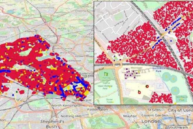
Many of these decisions are guided by the outcomes of so-called SEIR (susceptible-exposed-infectious-recovered) models that operate on a national level. Within HiDALGO, we are using our agent-based modelling expertise to develop the Flu And Coronavirus Simulator (FACS), an agent-based model that approximates the viral spread at the sub national level. FACS incorporates geospatial data sources from Openstreetmap to extract buildings and residential areas within the region. The code is developed as a collaborative effort between HiDALGO and the Brunel Computer Science Department, and is being updated on a daily basis. The various changes can be viewed in our open development repository here: https://github.com/djgroen/facs.
Using FACS, we can model Covid-19 spread on the local level, and provide estimations of the spread of infections and hospital arrivals, given a range of public health interventions. Such models, once verified and validated, can help to support local decision-making for an effective response to the epidemic with the health and social care capabilities.
Within HiDALGO, we have also leveraged our expertise in geospatial processing to develop tools for extracting buildings from local geographies. These scripts are general purpose, and can easily be adopted to create building graphs for further models. You can find the code for this in: https://github.com/djgroen/covid19-preprocess.